
Bukit in 2 Days: The Complete Route to the Peninsula’s Beaches, Viewpoints and Top Spots
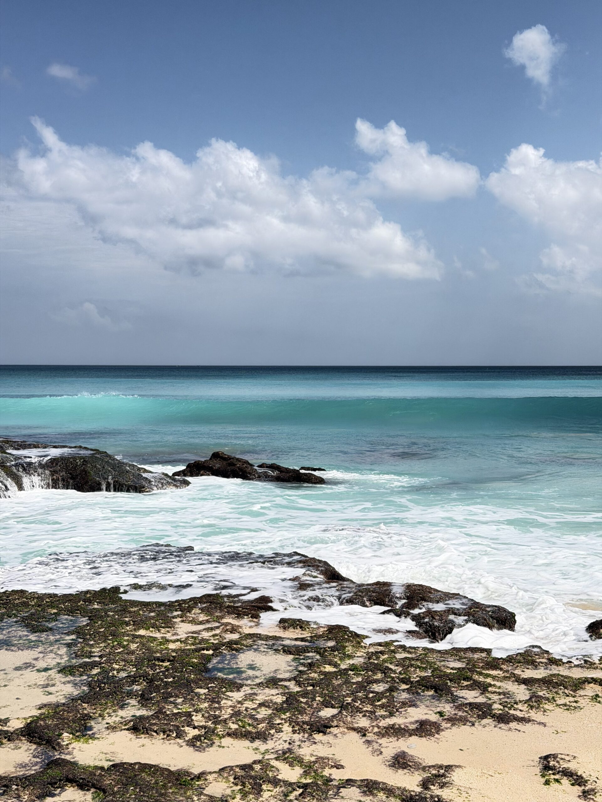
The Bukit Peninsula is the southern “tail” of Bali, connected to the main island by a narrow isthmus near the airport. Everything here feels different: instead of rice terraces you get dry limestone cliffs, drops of 50–70 meters, and beaches hidden beneath the rocks, reached by steep staircases. The Bukit is home to Bali’s most postcard-worthy views — turquoise water, white sand and walls of cliffs.
The main thing about the Bukit is that distances look short on the map, but the roads are narrow, winding and often end in sharp descents to the beaches. On top of that, every top spot has its own access road and its own climb down, which eats up time. So covering the whole peninsula in a single day is only possible at a gallop. If you want to actually see the places rather than rush past them, plan two days with an overnight stay right on the Bukit. That way you split the route in half, don’t get worn out by the driving, and catch different light: sunset on the west coast on day one, morning light on the east on day two.
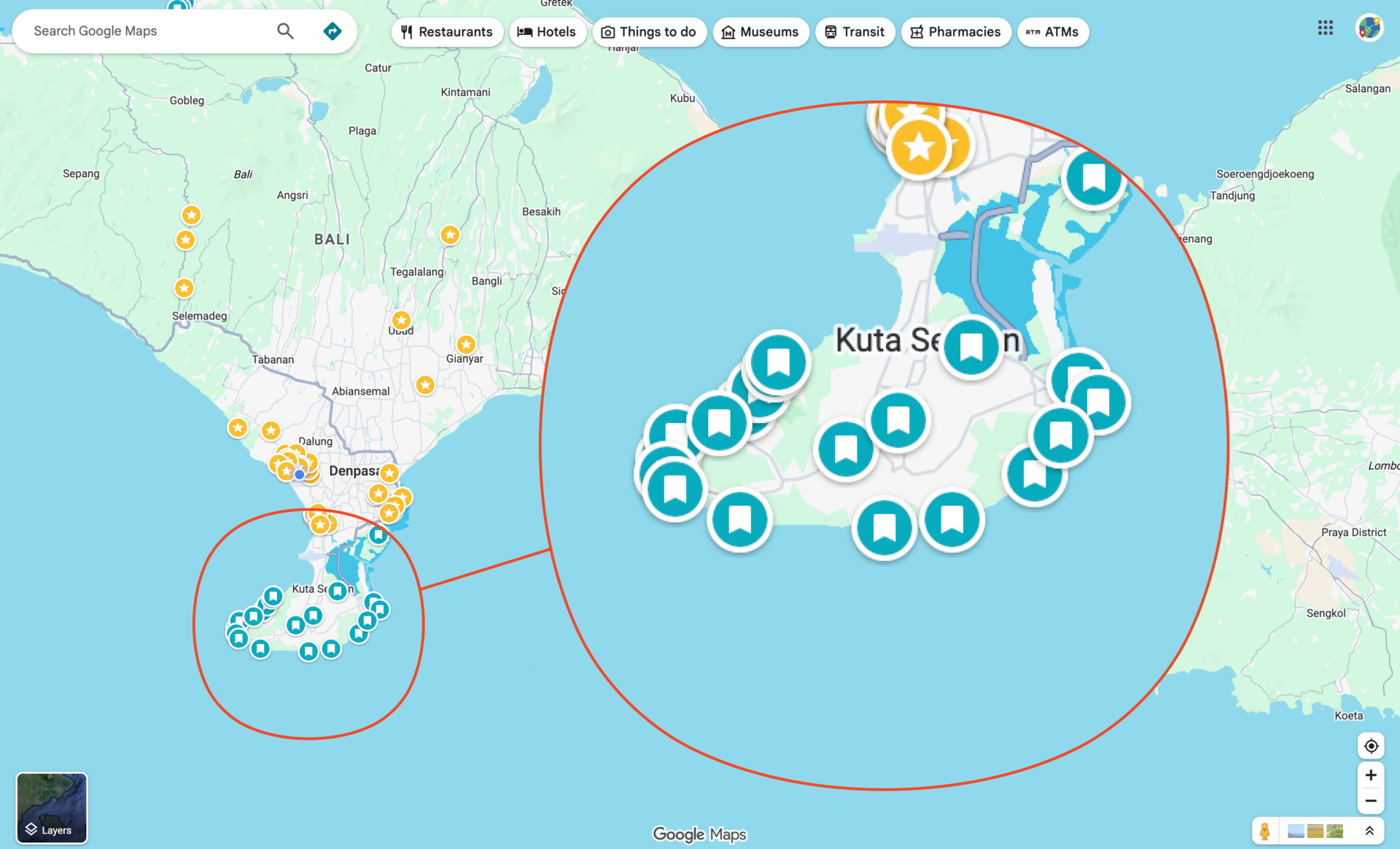
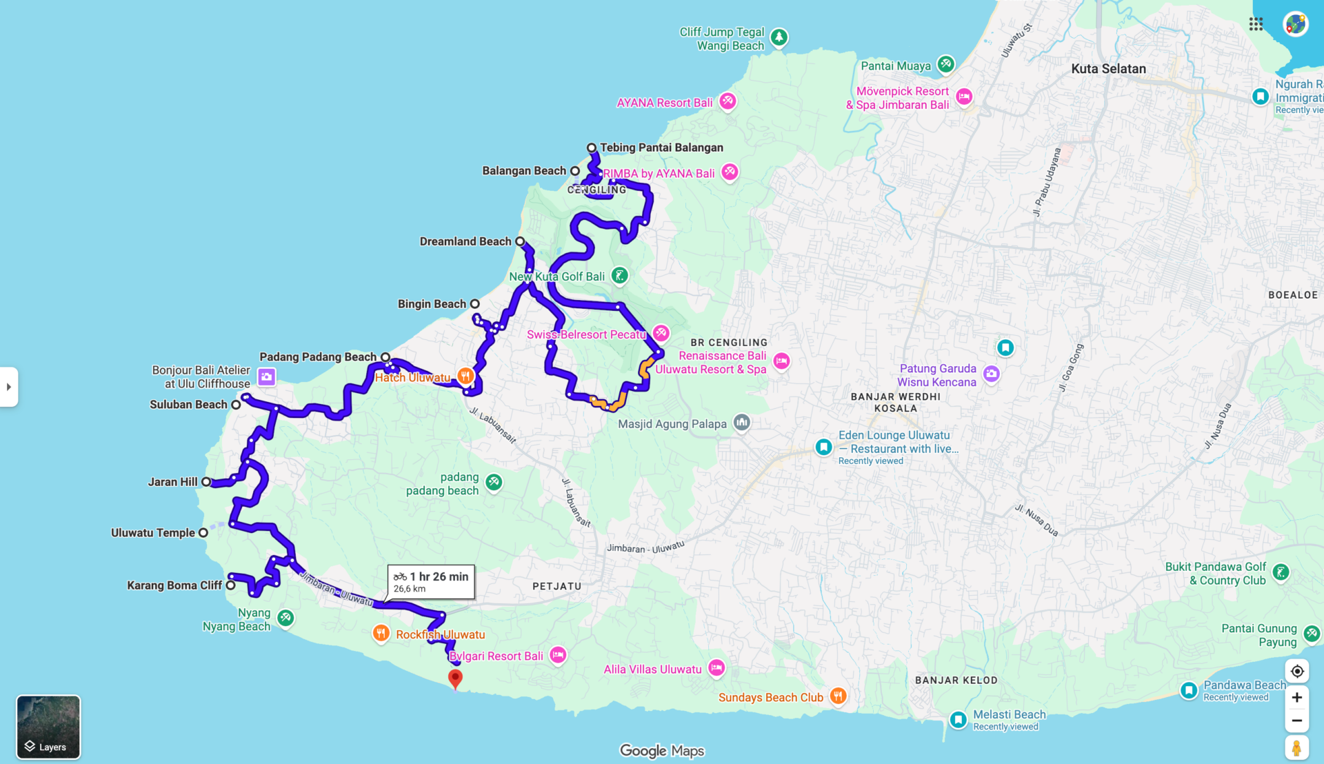
Below is the route in order, following the coastline. We drove it ourselves and split it logically: Day 1 — the entire west and southwest coast from Balangan to Uluwatu and on to Nunggalan, where we stay for the night. Day 2 — south and east: from Garuda Wisnu Kencana through Melasti and Pandawa to Nusa Dua. Don’t worry about the names — I’ll show and explain everything, and at the end I’ll share a map of all the spots so you can add them all to your Google Maps in one click and set off exploring!
How to get around: scooter or driver
We explored the Bukit by scooter — and that’s convenient in itself: total freedom, easy to park at any spot, no dependence on anyone. But honestly, the roads here are tough in places. Narrow switchbacks, steep descents to the beaches, broken dirt tracks on the approaches to the viewpoints — some access roads are genuinely difficult, especially if you’re not very confident on a scooter.
The alternative is to hire a driver for the day and do the whole route with them. It’s noticeably more comfortable: no worrying about roads and parking, you can relax between stops, and the cost is quite reasonable. Especially if you’re traveling as a group, don’t like driving on mountain roads, or simply want to take in the scenery — this option is better. For confident riders a scooter gives maximum freedom; for comfort and zero stress, a driver.
Here are approximate prices for a car with a driver, from 650,000 IDR (roughly 40 USD):

You can reach out to this company directly and ask about everything. Further down the article there’s a list of all the spots — you can copy it and send it to the company, say you’d like to see these places over 1 or 2 days, and ask how much it would cost and whether they have drivers available.
Day 1. West coast: from Balangan to Nunggalan
The west side of the Bukit is the classic Bali: surf beaches, cliffs and sunsets over the ocean. It’s also home to the most famous spots, so it’s best to start early. We didn’t set off super early, and this is exactly the case where an extra hour in the morning saves you half a day in the crowds later on.
A tip: naturally, all the beaches and viewpoints look better at high tide, and this can change your impression significantly. If you can, aim for a window about 3–4 hours before high tide — that way the whole route will have a good water level and you’ll catch it at its most beautiful.
You can check tide levels in any weather or tide app (for example Tide Charts or Windy).
Now let’s go through each spot in order.
1. Tebing Pantai Balangan (viewpoint above Balangan Beach)
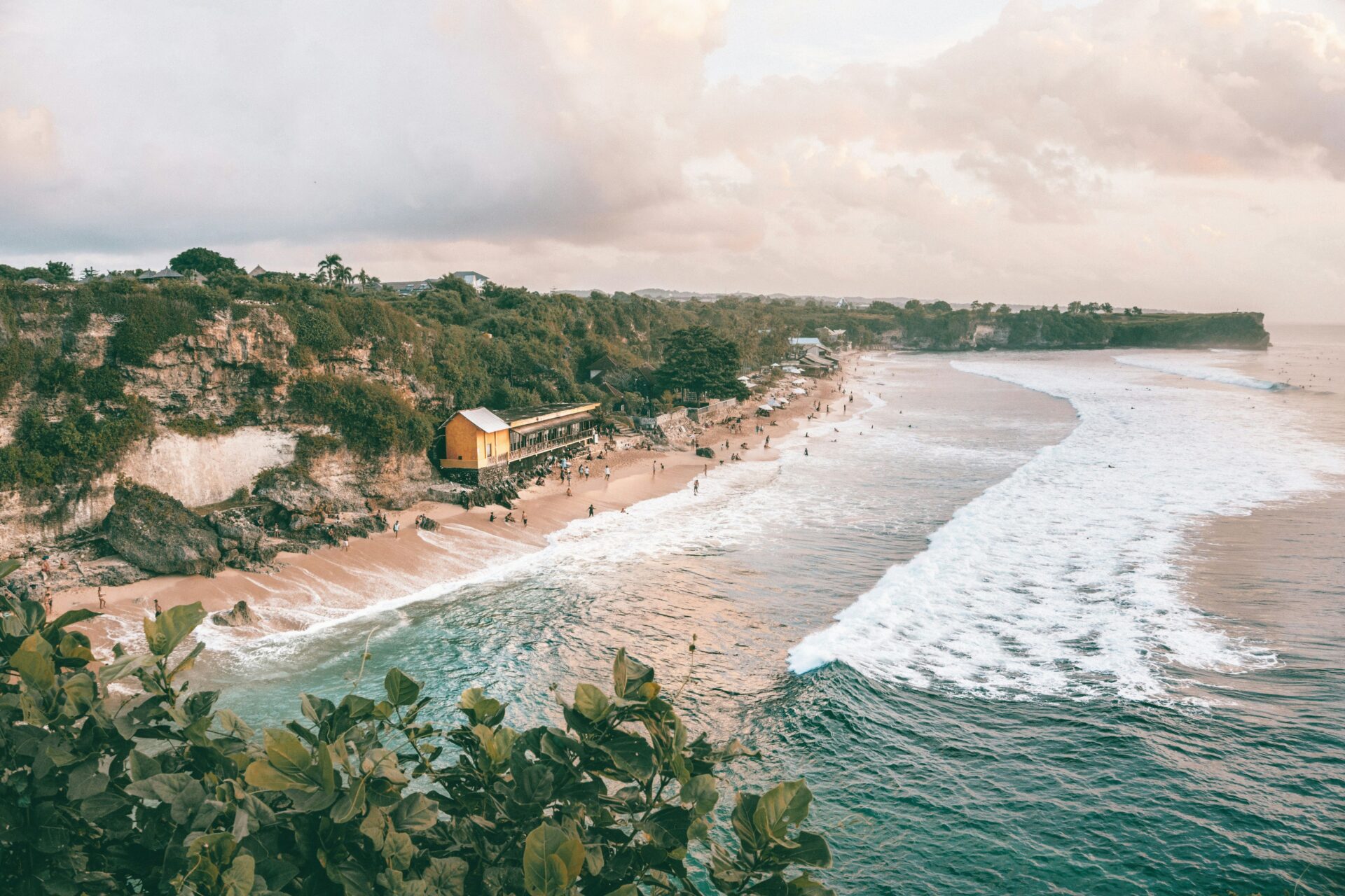
We start from the top — on the cliff above Balangan Beach. “Tebing” means “cliff” in Indonesian. From here you get a view over the entire curve of the beach, the line of surfers on the waves, and the coast stretching to the horizon. The perfect first stop to grasp the scale of the peninsula before heading down.
- Road and parking: access via the upper road, parking along the roadside and by the local warungs. The viewpoint is a couple of minutes’ walk away
- Photo spot: the best shot is from the cliff edge over the curve of the beach; the light is softer toward evening, but there are fewer people in the morning
- Time: 15–20 minutes for the view and photos
2. Balangan Beach
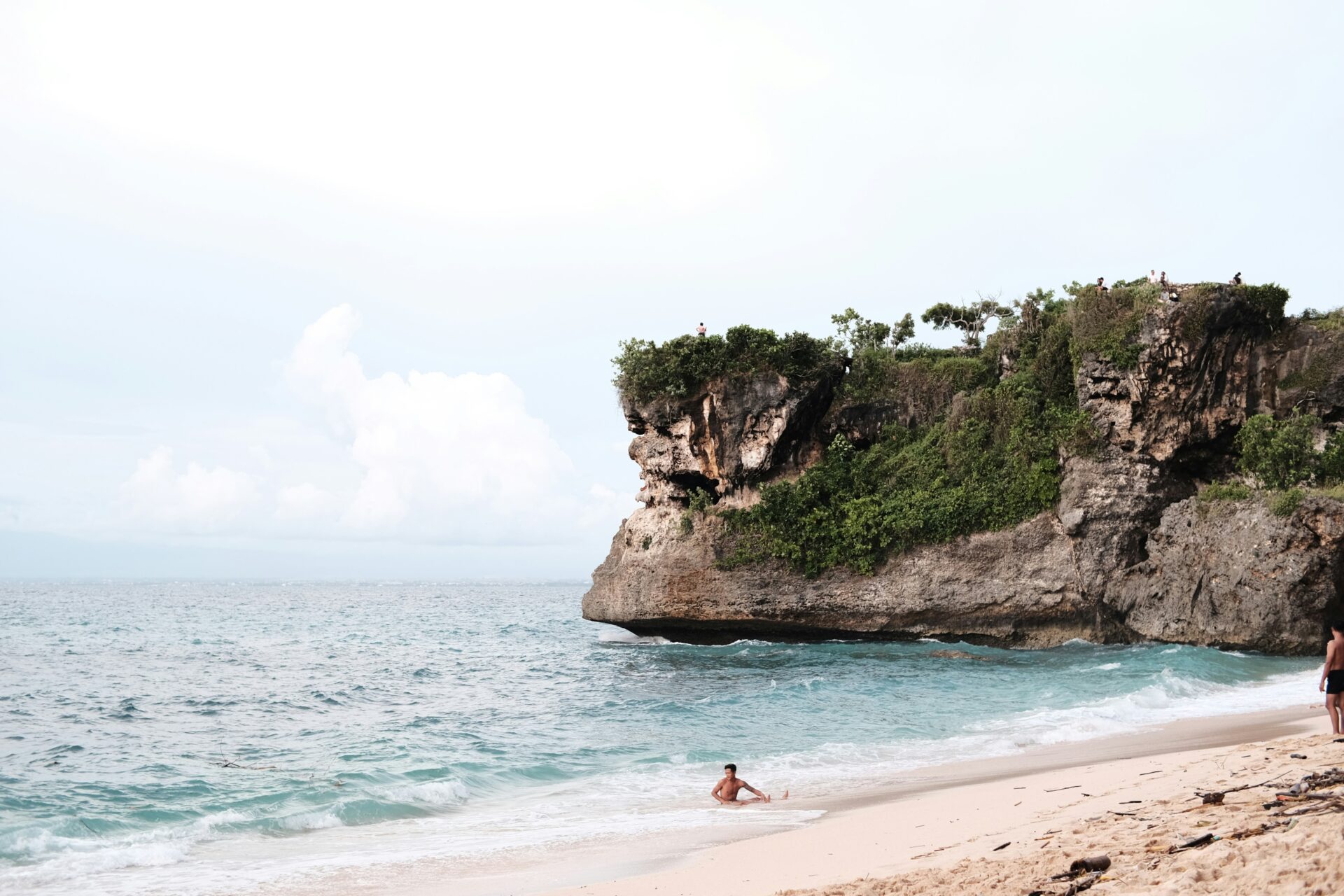
We head down to the beach itself. Balangan is a long stretch of light sand beneath the cliff, with a row of warungs and sun loungers up top and good surf — though not for beginners. The vibe is relaxed and less touristy than the more hyped-up neighboring beaches. A great first “anchor” of the day — coffee with a view, feet in the sand, watching the surfers.
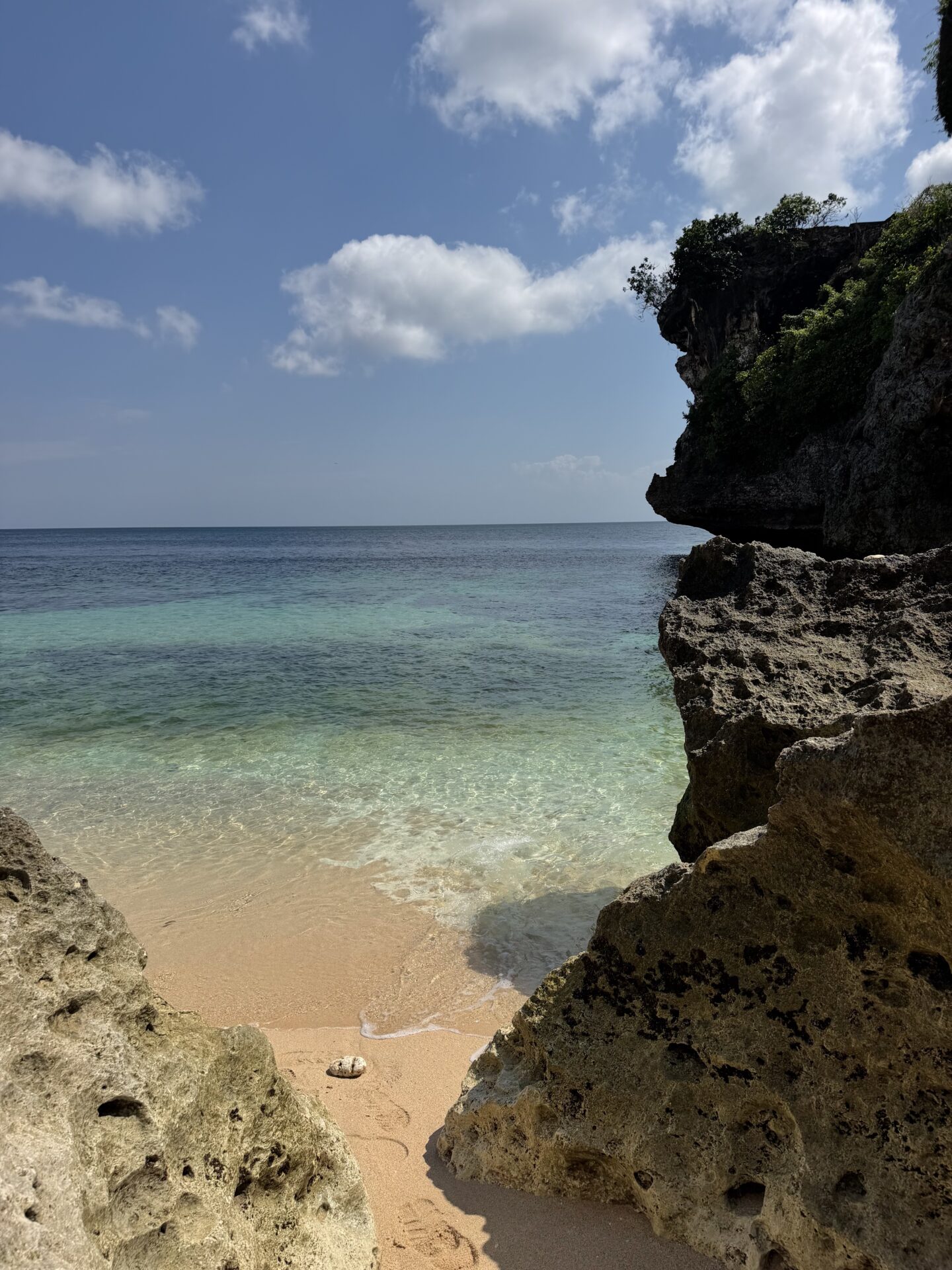
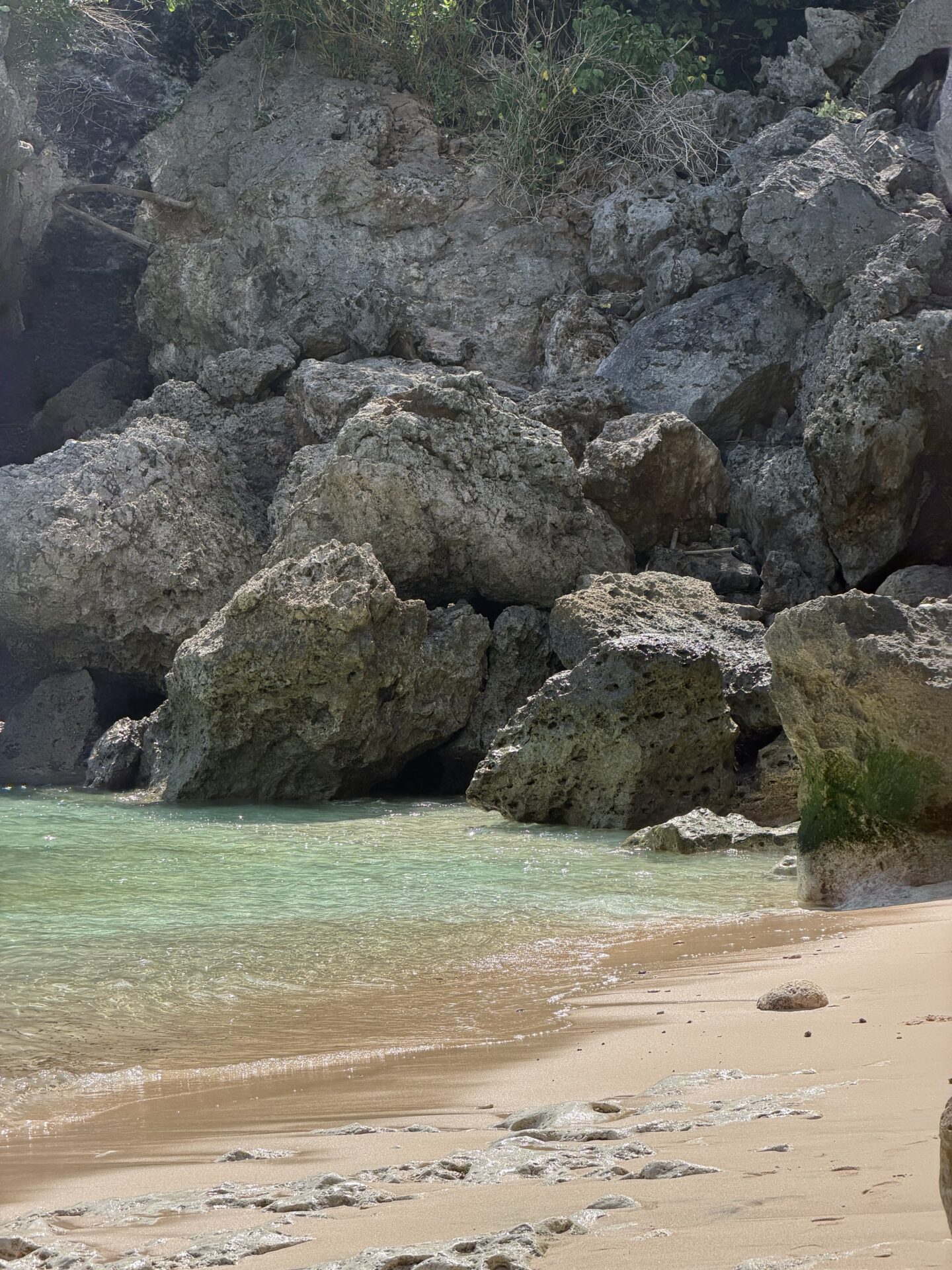
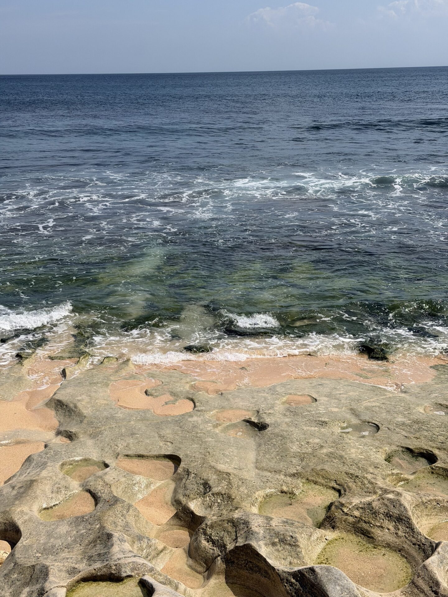
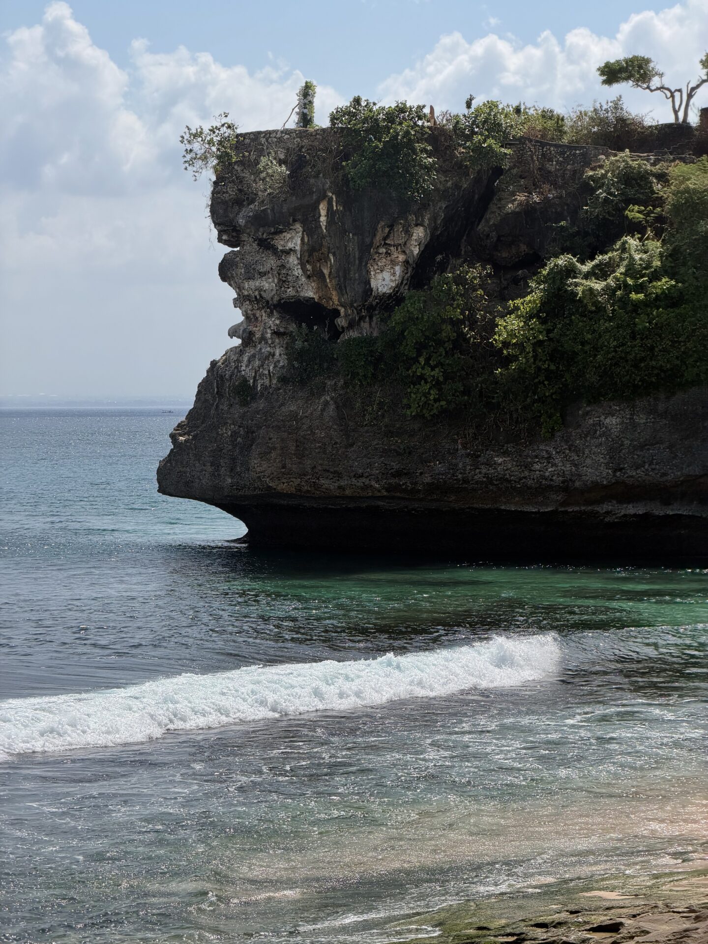
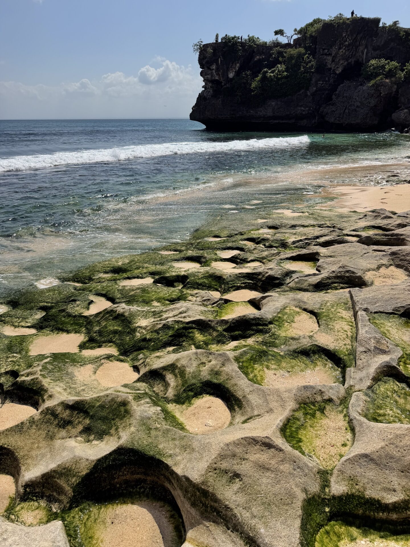
In the other direction there’s a wide beach with umbrellas and loungers, plus calmer spots with no waves and a gentle entry into the water.
- Road and parking: a separate turnoff down, paid parking at the entrance. From the parking to the water it’s a short walk down the stairs
- Highlights: in places there’s a beautiful rocky shore, cliffs and boulders you can walk up to, with cozy spots for a swim
- Time: from 30 minutes to a couple of hours if you want to linger
3. Dreamland Beach
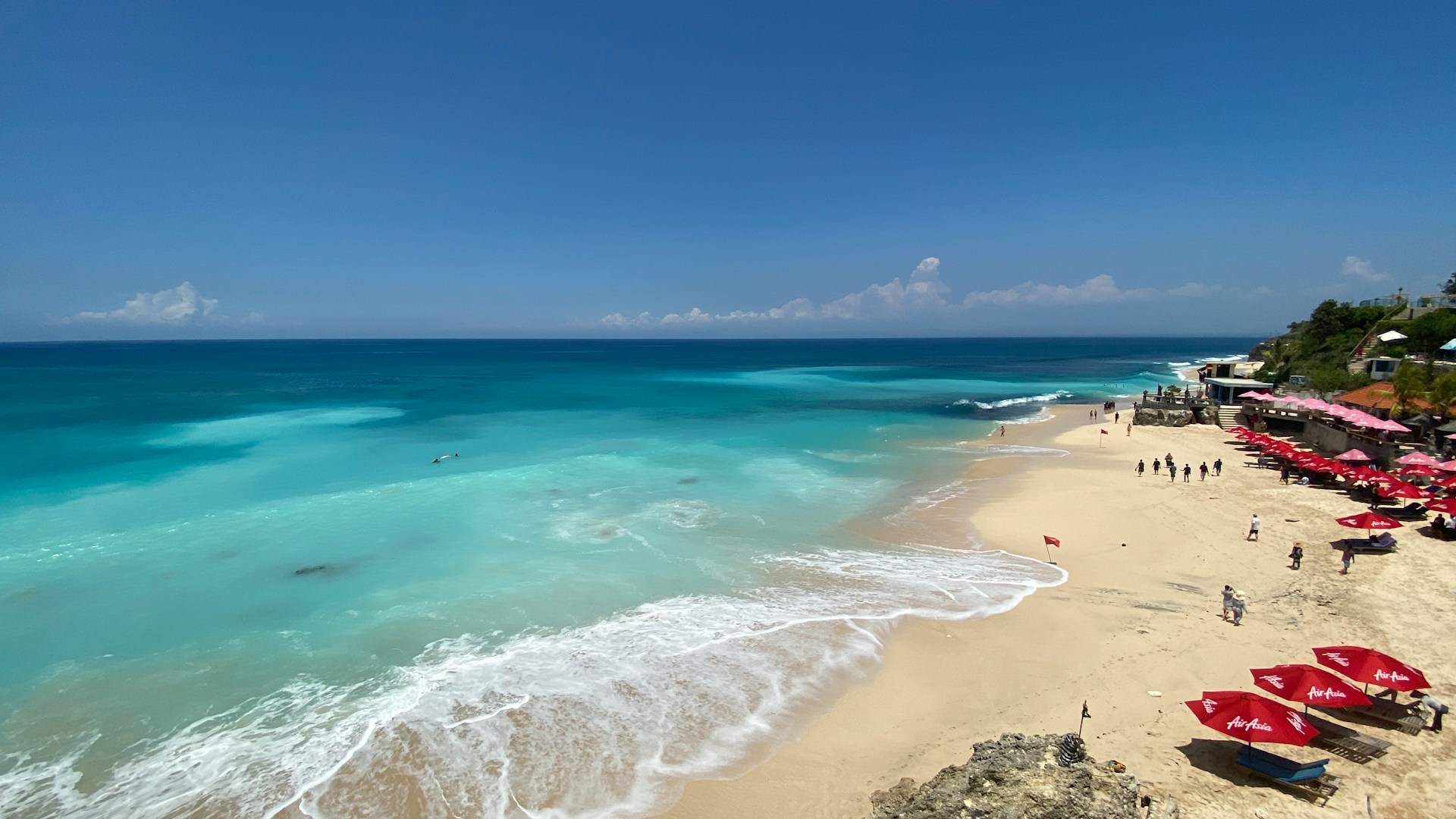
Next along the coast is Dreamland. A wide beach with big waves, surrounded by cliffs. More polished and busier: there’s development nearby, loungers and cafes. The waves can be powerful, so swim carefully and watch the flags. It’s great for its sheer scale and open views.
- Road and parking: the access is fine, with parking right by the descent to the beach
- Highlights: strong currents and big waves — not the best beach for small children, but very beautiful
- Time: if you’re just looking, 20 minutes is enough, but you can stay 40–60 minutes and swim
4. Bingin Beach
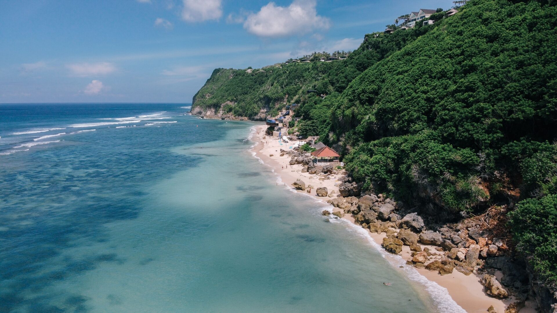
One of the most atmospheric beaches on the Bukit. Bingin is a maze of small guesthouses and cafes clinging to the cliff, with a narrow strip of sand below. The descent is steep and long, down steps between the buildings — but that’s exactly what gives the place its character. Down below: perfect turquoise water, reefs and the famous surf break.
- Road and parking: parking up top, then only on foot down the stairs (a few minutes down, uphill on the way back)
- Photo spot: the view from above over the beach and azure water, sunset shots from the cafe terraces
- Highlights: at low tide the reef “pools” open up. Comfortable shoes are better — the descent is uneven
- Time: at least an hour to go down, sit for a while and climb back up
5. Padang Padang Beach
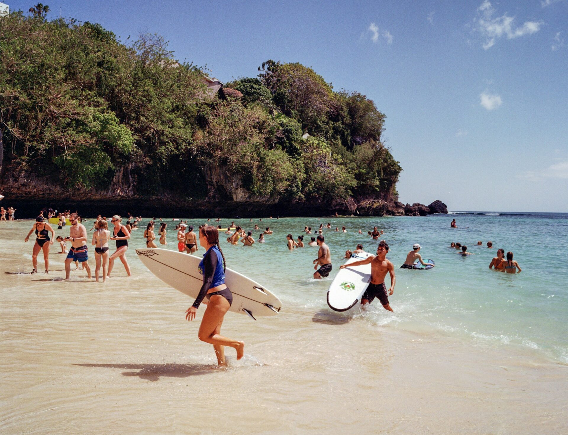
A small beach whose main draw is the entrance itself, through a crevice in the rock: you squeeze through a narrow passage and stairs and come out onto a compact beach wedged between the boulders. Very picturesque.
- Road and parking: parking by the road, paid entry, 15,000 IDR per person
- Photo spot: the crevice passage in the rock and the view of the beach between the boulders
- Highlights: small and fills up quickly. Nearby is Padang Padang, a well-known surf wave (for pros).
- Time: 20 minutes if you’re not swimming
6. Suluban Beach
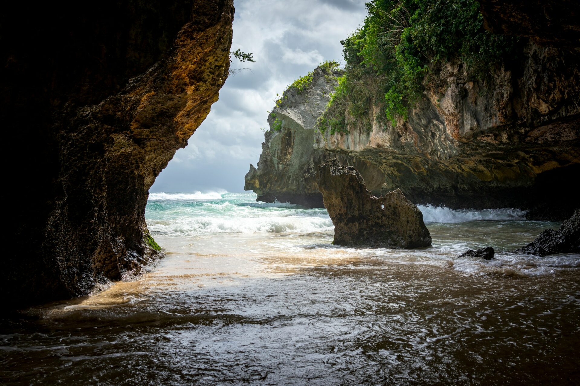
Suluban is less a beach and more a system of grottoes and passages between the rocks, filled with turquoise water. You head down past surf bars clinging to the cliff, duck under stone arches, and reach the water through caves. One of the most photogenic spots on the Bukit. It’s also where surfers head out to the legendary Uluwatu break.
At low tide the passage to the beach itself is accessible; at high tide you can only admire the beauty and the waves between the rocks — but either way it’s worth it at any water level.
- Road and parking: parking at Blue Point, then down on foot through the shopping rows and stairs
- Photo spot: stone arches and grottoes, water in the passages, surfers against the cliffs
- Highlights: at high tide part of the passages flood — best access at low tide. Check the tide schedule
- Time: 30 minutes
7. Jaran Hill
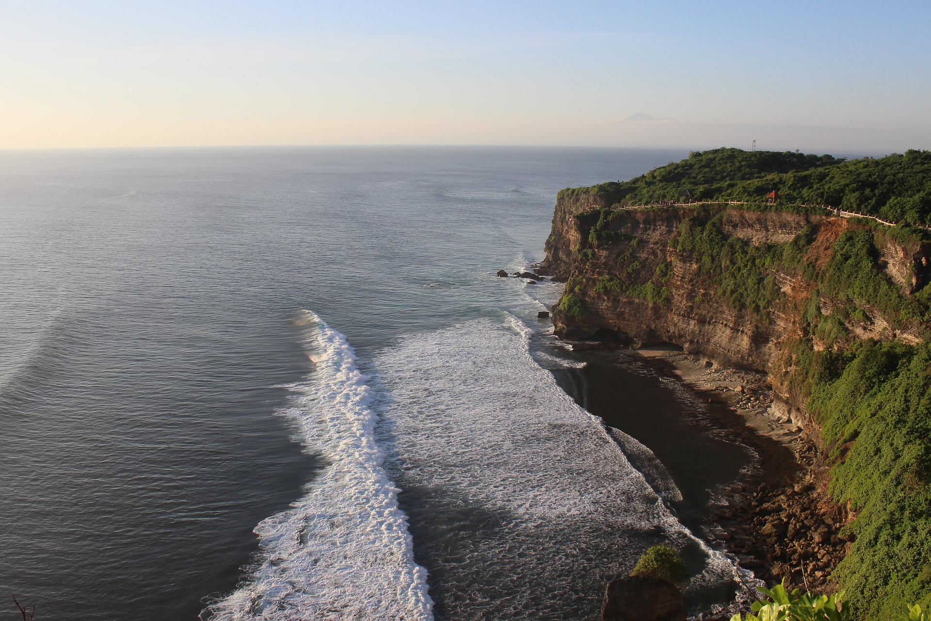
A small viewpoint hill, less hyped than its neighbors — which is why it’s quieter and calmer here. Views over the coastline and cliffs, a good place to catch your breath after the crowds of the western beaches, before the main Uluwatu sights. Those who make it here rate it highly precisely for the atmosphere.
- Road and parking: access via secondary roads, parking by the trail. A short walk
- Photo spot: open panorama of the coast, sunset shots
- Time: 30 minutes
8. Uluwatu Temple (Pura Luhur Uluwatu)
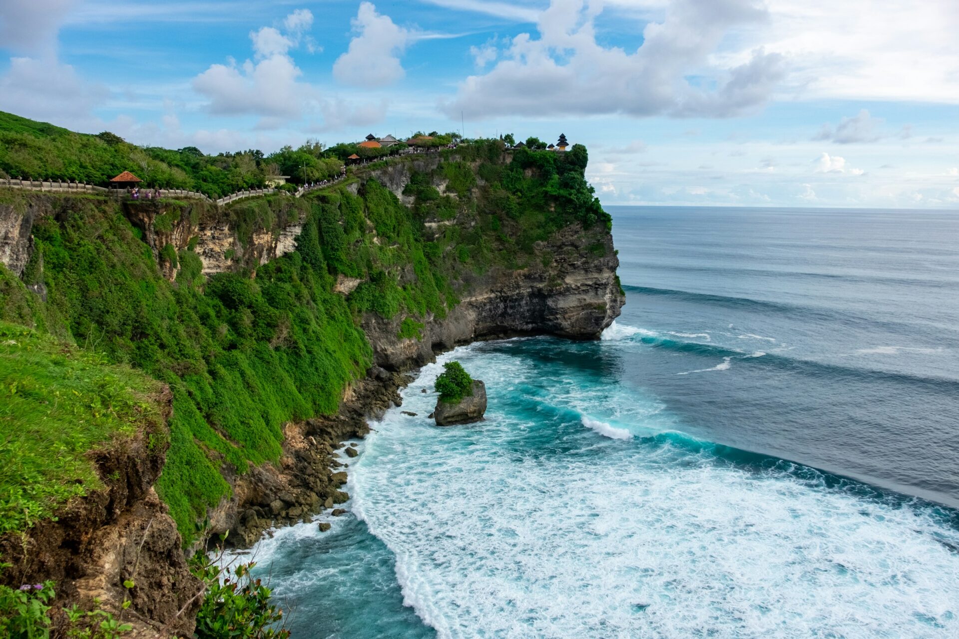
The main temple of the Bukit, standing right on the edge of a 70-meter cliff. One of Bali’s key sea temples. The views from here are among the best on the whole island: the temple, the cliff, the ocean to the horizon. At sunset they perform the Kecak Fire Dance in the open air — a powerful spectacle if you catch it.
- Road and parking: a large parking lot, paid entry. At the entrance they hand out a sarong (required to enter the grounds)
- Photo spot: the temple on the cliff edge, the panorama of the cliffs, a silhouette at sunset
- Highlights: ⚠️ watch out for the monkeys — they’re bold and steal glasses, phones and hats. Put away anything sticking out of your pockets and hold your things tight. The Kecak dance starts around sunset — buy tickets in advance, it’s cheap and easy on trip.com, and arrive with time to spare, as it gets crowded.
- Time: 1–1.5 hours, up to 2 hours with the dance
9. Karang Boma Cliff
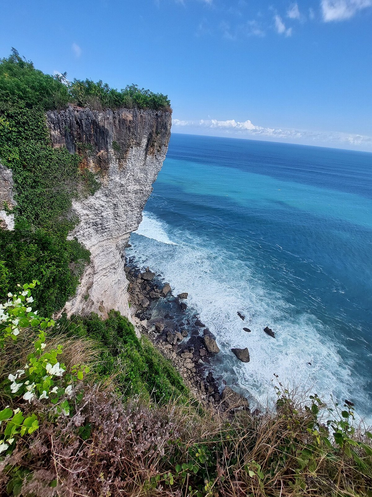
A famous cliff not far from Uluwatu — the very postcard rock where the coast is “cut” by a V-shaped ravine with vertical walls dropping into the ocean on both sides. One of the most dramatic spots on the peninsula for photos. There’s almost no infrastructure — just a trail and the view. It fits perfectly at the end of the day: it’s near Uluwatu, and the sunset here is one of the best on the Bukit.
- Road and parking: access via a dirt track, parking with the locals for a small fee, then on foot along the trail to the cliff
- Photo spot: the V-shaped split in the rock with water below — the signature shot of the Bukit. Best light is in the evening
- Highlights: in places there are no railings, and the cliff edge is genuinely dangerous — don’t go right up to the edge. It’s windy
- Time: 30–40 minutes
Heading to the hotel to rest
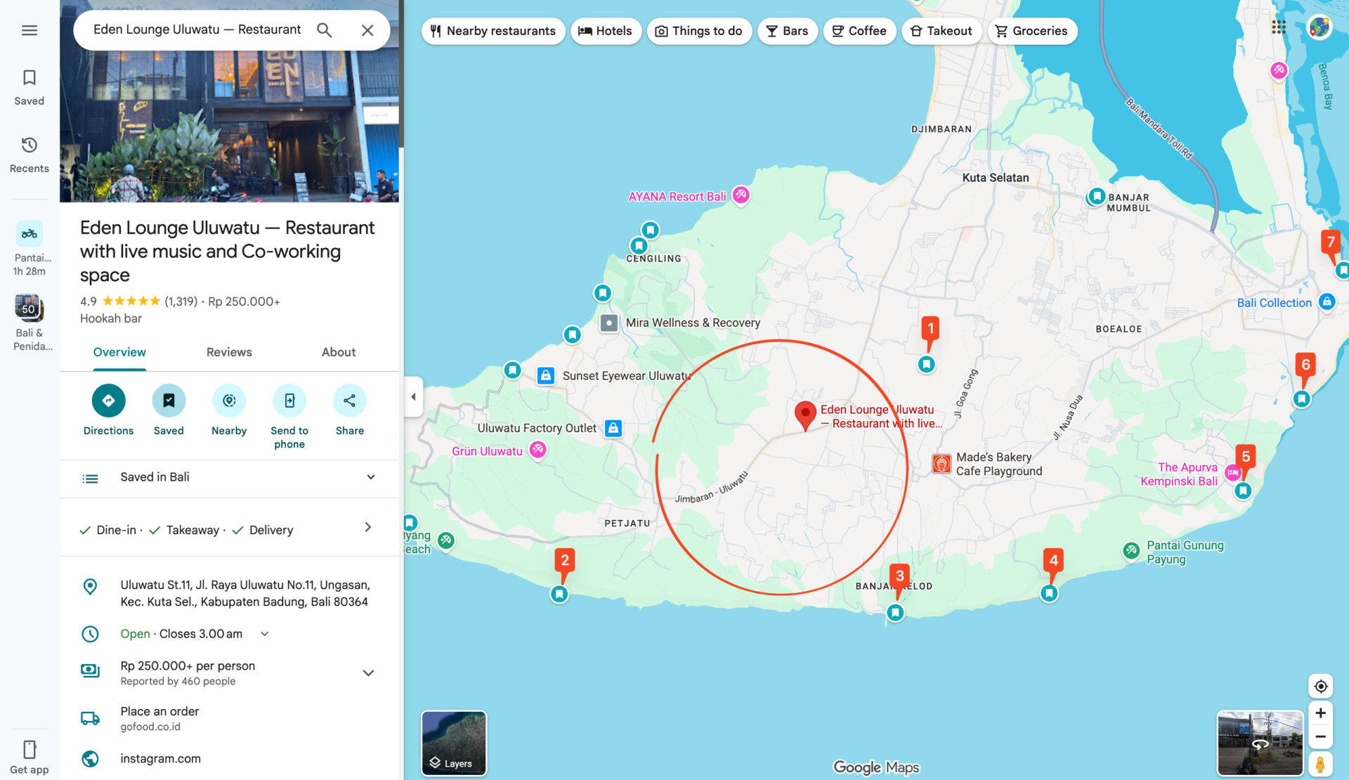
💡 Dinner to end the day: a great way to wrap up day one is Eden Lounge Uluwatu, a restaurant-lounge on the way toward the center of the peninsula. Use this area as a reference and choose a hotel for the next day. The first two stops can be swapped and the order chosen based on where your hotel is:
You can easily adjust the route to your goals
We’ve built a route planner for your trips. If you need to change something in the route or find out more about a place, you can simply ask your question in the chat https://app.itinerary.city/chat, for example like this:
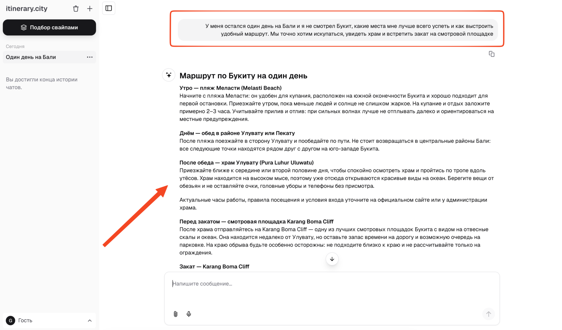
And you’ll get a ready-made, personalized route for your situation. It can help with any country in the world — I highly recommend giving it a try and supporting the project ❤️
Day 2. South and east: from Garuda Wisnu Kencana to Nusa Dua
Day two is all about contrast. Where the west of the Bukit is wild and rocky, the east and south are gentler, with well-kept beaches and calm water (the Indian Ocean side is sheltered by reefs here). We start with the main cultural landmark, then follow the coast to the most postcard-perfect beaches of the peninsula.
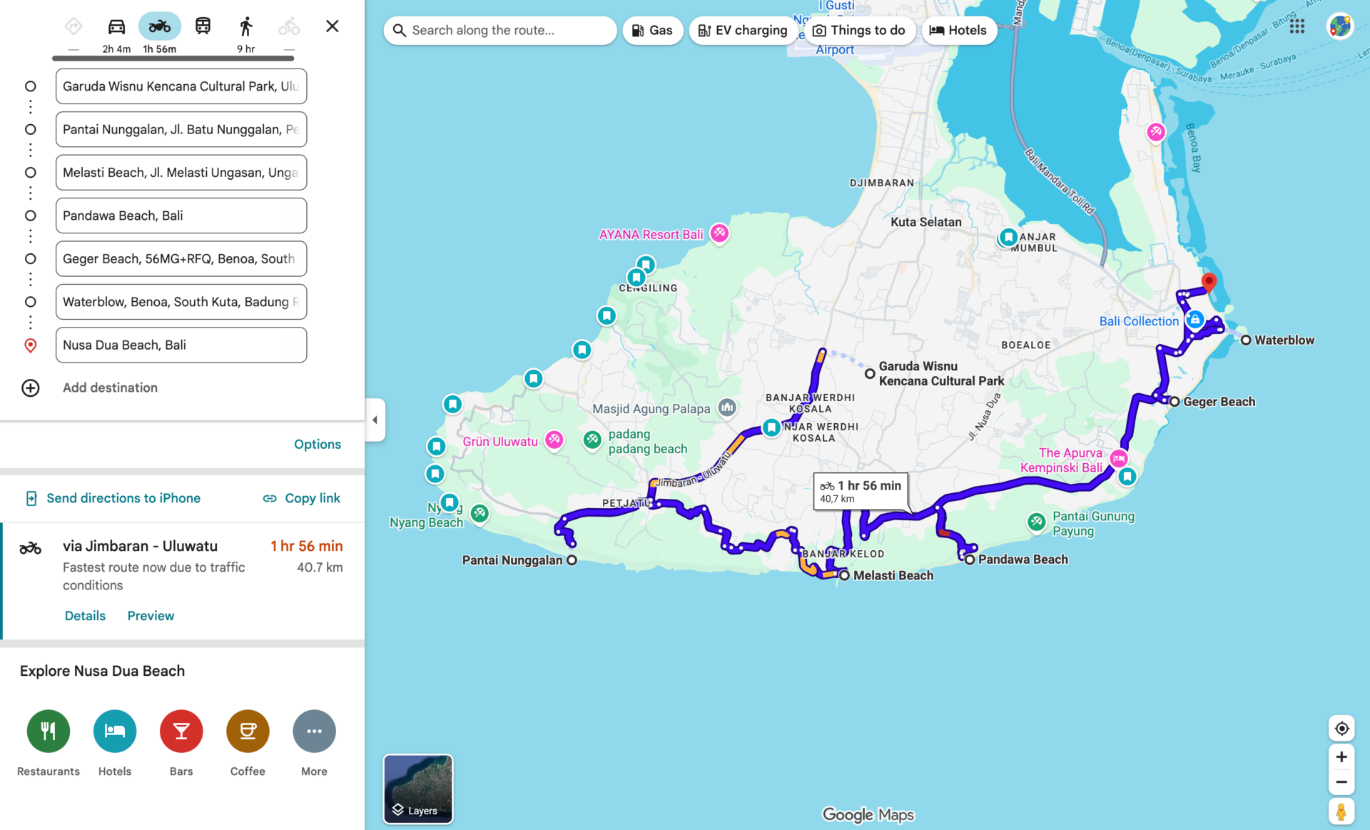
10. Garuda Wisnu Kencana Cultural Park (GWK)
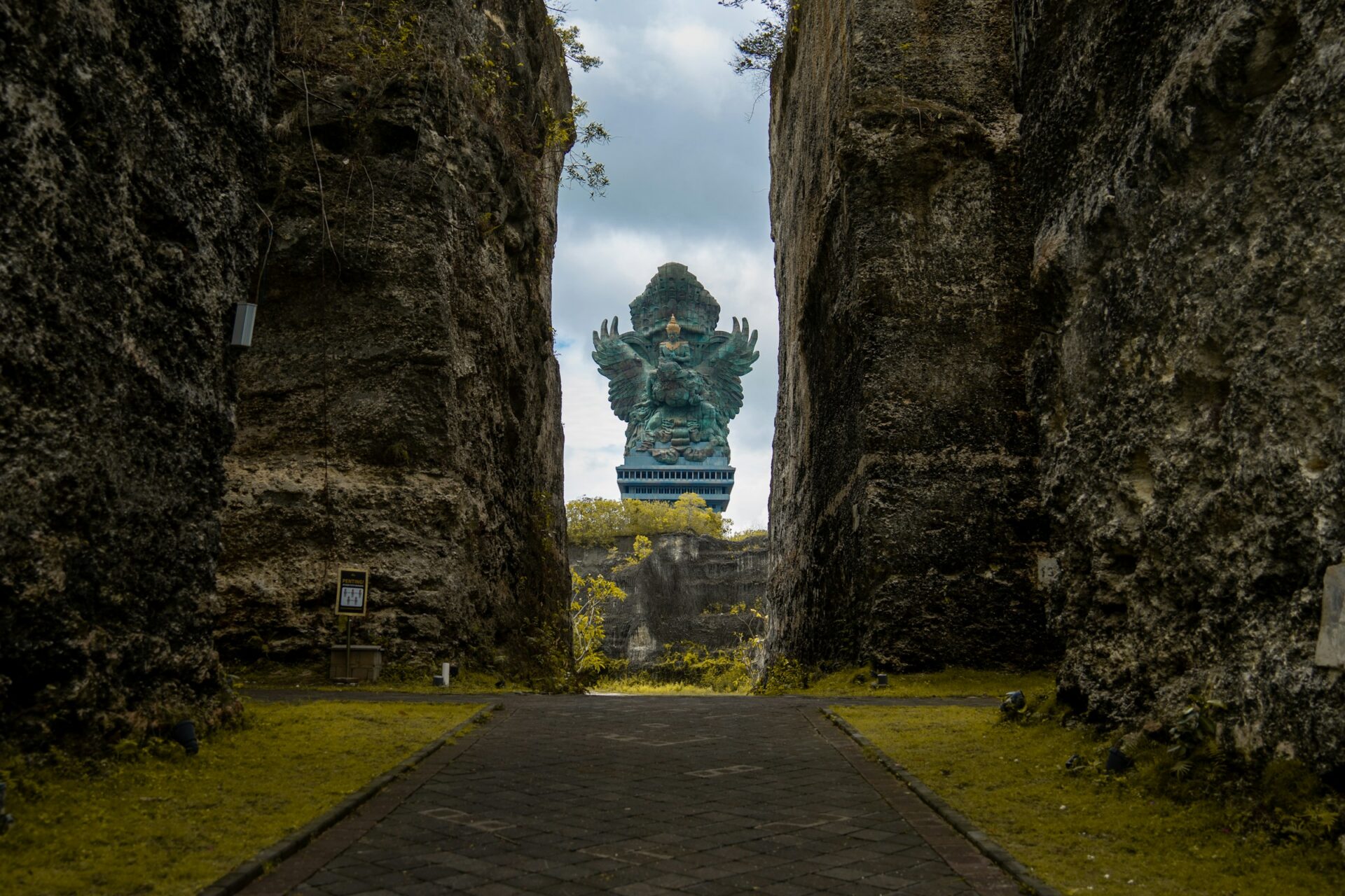
We start day two at a huge cultural park with a giant statue of the god Vishnu riding Garuda — one of the largest statues in the world. The scale is impressive: the statue is visible from far away, and the park itself is a series of plazas, stone corridors, viewpoints and cultural performances (dances, shows). A good morning stop: you get there before the heat and the crowds.
- Road and parking: a large organized parking lot, paid entry (the ticket is noticeably pricier than the beaches — it’s a paid attraction); it’s better to buy in advance on trip.com
- Photo spot: the Garuda-Vishnu statue in full and from below, the stone corridor walls
- Highlights: the grounds are large — allow for walking. Check the schedule of performances for the day of your visit
- Time: 1.5–2 hours
11. Pantai Nunggalan
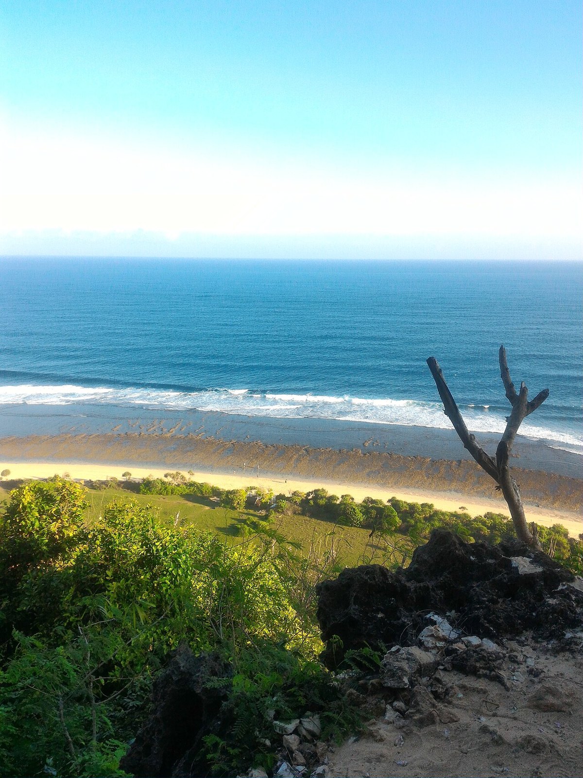
A wild, quiet beach reached by a long, steep descent (many call it the toughest on the Bukit — easy down, hard up). The reward is an almost empty, wide beach, the famous rusty hull of a sunken ship on the sand, and a complete sense of solitude.
- Road and parking: parking up top, then a long descent down a trail/stairs (allow time and energy, especially for the climb back)
- Photo spot: the old shipwreck on the sand, the wide empty beach
- Highlights: a wild beach with minimal infrastructure — bring water. The climb back is tough, so save your energy for the next stops
- Time: 1.5–2 hours including the descent and climb
12. Melasti Beach (Pantai Melasti)
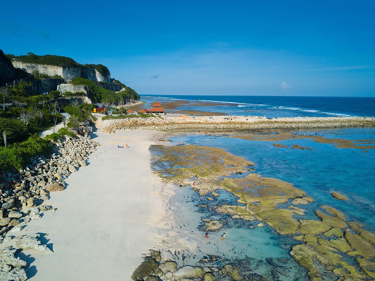
One of the most striking beaches on the Bukit. It’s reached by an impressive road cut straight through the white limestone cliffs — the descent itself is an attraction. Below is a wide beach with turquoise water, beach clubs and a calm entry into the water. Great for swimming and relaxing.
- Road and parking: the famous serpentine road through the cliffs, parking down by the beach. Paid entry
- Photo spot: the road cut through the white cliffs (from above and below), turquoise water, beach clubs at sunset
- Highlights: there are beach clubs — you can combine it with lunch. The water is calmer than on the west
- Time: 1–2 hours
13. Pandawa Beach (Pantai Pandawa)
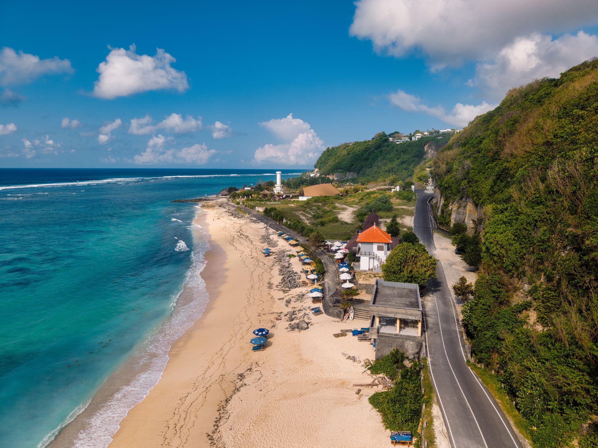
The “secret beach” — that’s what it was called until a road was cut through the cliff to reach it. At the entrance are the famous stone niches with figures of the five Pandava brothers carved into the rock. The beach itself is long and clean, with turquoise water, loungers and canoes for rent. One of the most convenient and family-friendly beaches on the Bukit.
- Road and parking: entry through the stone “corridor” with the statues, a large parking lot. Paid entry
- Photo spot: the Pandava statues in the rock niches, the panorama of the beach from the road above
- Highlights: calm water, suitable for swimming and families
- Time: 1–1.5 hours
14. Geger Beach (Pantai Geger)
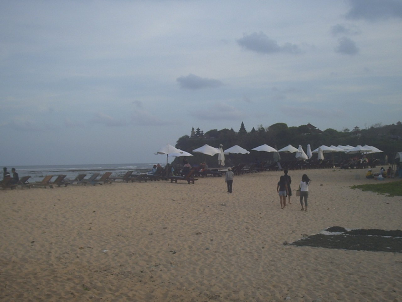
A quiet, less touristy beach near Nusa Dua. Calm, shallow water behind the reef, white sand, and a temple on the nearby headland. A good place to catch your breath between the busier spots — it’s noticeably calmer and more pleasant for a leisurely swim.
- Road and parking: access from the Nusa Dua side, parking at the entrance
- Highlights: very calm water (sheltered by the reef), few waves — comfortable for swimming. Some seaweed in places
- Time: 40–60 minutes
15. Waterblow (Nusa Dua)
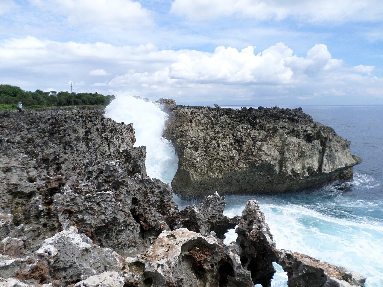
A rocky platform where the ocean waves crash and throw powerful fountains of spray several meters into the air. Dramatic and completely unlike the calm Nusa Dua beaches nearby. A great second-to-last stop before the final relaxation on the beach.
- Road and parking: within the Nusa Dua resort area, paid entry, a short walk from the parking along the promenade
- Photo spot: fountains of spray against the cliffs and ocean — catch the moment a wave hits
- Highlights: ⚠️ don’t go right up to the edge — the waves are unpredictable and powerful. More spectacular at high waves/high tide
- Time: 20 minutes
16. Nusa Dua Beach
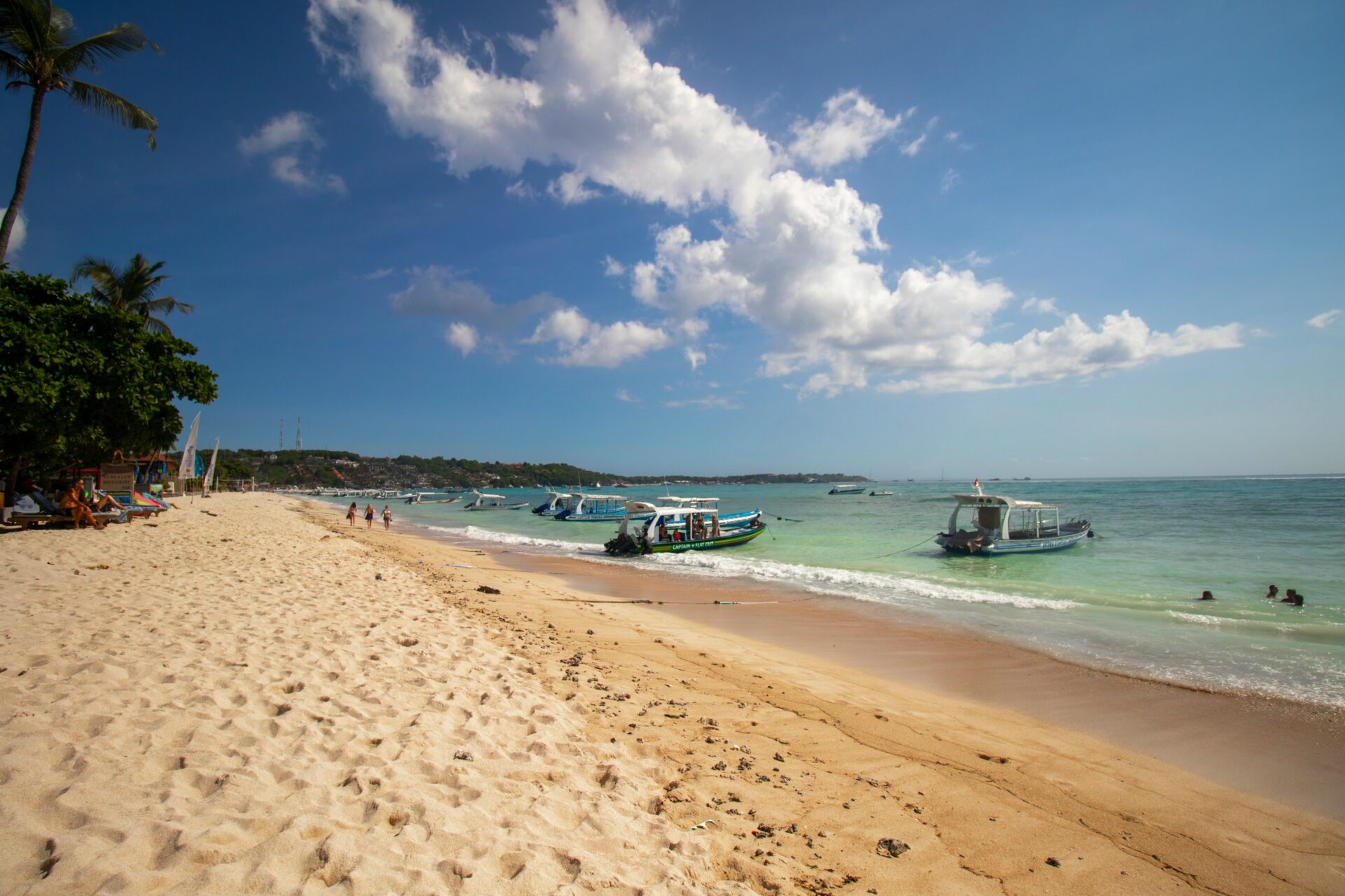
The finale of the route — the beach of the Nusa Dua resort area: well-kept, clean, with perfect white sand and calm water. Along the shore are large hotels and a promenade. The atmosphere is more “resort” and organized than the wild west coast. A good spot to finish the two-day tour in comfort.
- Road and parking: access through the resort area, organized parking lots. Part of the beach runs along the hotels, and there are public entrances
- Photo spot: white sand, smooth turquoise water, the promenade
- Highlights: calm water, everything is civilized. The perfect way to close out the route with some relaxation
- Time: 1–2 hours if you stop and swim
Practical tips for the whole route
- Transport. Ideally a scooter (mobility on the narrow roads and parking) for confident riders, or a car with a driver if you’re traveling as a group or don’t want to drive the switchbacks. The roads are winding, with steep descents to the beaches in places.
- Tides. Half the western beaches (Suluban, Bingin, and to some extent Balangan) depend heavily on the tides — best access and views at low tide, while peak beauty comes at high tide. Check the tide chart for your travel days in advance.
- Monkeys. Around Uluwatu Temple the monkeys steal glasses, phones and hats. Put away anything loose.
- Shoes and water. The descents to the beaches are steep and long (especially Nunggalan and Bingin). Comfortable shoes and water with you are a must.
- Safety on the cliffs. Karang Boma, Waterblow and most viewpoints have no railings. Don’t go up to the edge, especially in the wind.
- Money. Almost everywhere has paid parking and entry (cash, small notes). Keep a stock of rupiah.
- Light. The west of the Bukit is about sunsets (Uluwatu, Karang Boma, Nunggalan, Eden Lounge). The east and south (Nusa Dua, Geger) are nicer in the morning. The route is built exactly for this: day one’s sunset on the west, day two’s start on the east.
- Where to stay. The Uluwatu / Pecatu area is the ideal base: a concentration of villas, guesthouses and cafes, convenient for starting out in both directions.
This route covers the whole Bukit — all the main beaches, viewpoints and top sights of the peninsula — over two full but not exhausting days. The west coast for dramatic cliffs and sunsets, the east for calm swimming and postcard views. And in between, a night on the peninsula itself, so you don’t waste time driving back and forth.
Route map: all the spots on Google Maps
As promised — the whole route on the map. There are a lot of spots, so I split them into two ready-made routes by day: click the link and Google Maps opens the whole path with the stops in order, and you can start navigation or save it right away.
🗺️ Day 1 (west coast, in order): https://maps.app.goo.gl/1P6QtpnPK6Q9aihLA
🗺️ Day 2 (south and east, in order): https://maps.app.goo.gl/kuAnbxJjPxMdR3zw8
And all the spots on the route as a list:
Day 1 — west coast:
- Tebing Pantai Balangan
- Balangan Beach
- Dreamland Beach
- Bingin Beach
- Padang Padang Beach
- Suluban Beach (Blue Point)
- Jaran Hill
- Uluwatu Temple
- Karang Boma Cliff
- Dinner to end day one: Eden Lounge Uluwatu
Day 2 — south and east:
- Garuda Wisnu Kencana (GWK)
- Pantai Nunggalan
- Melasti Beach
- Pandawa Beach
- Geger Beach
- Waterblow (Nusa Dua)
- Nusa Dua Beach
Open this link on your phone with Google Maps installed https://maps.app.goo.gl/efu5z9LSxCEyrQLa6 — all the spots will load in the app, and you can save them all in one click. This map covers Bali and includes all the Bukit spots along with other places we visit. The map is updated over time!
I hope this article was useful and answered all your questions — and if not, message me on social media or in the chat on the site, and I’ll do my best to help and advise.